1
INSTRUCTIONS
FOR COMPLETING
AN APPLICATION FOR
A CONDITIONAL
WATER PERMIT
January 2024

1
1. Complete all applicable blanks on the application form. If the application is not satisfactorily completed, it will be
returned.
2. If an appropriation involves the storage of water, both the quantity of water which will be stored at the level of the
principal spillway and the quantity which will be lost to evaporation from the corresponding surface area must be
identied in item #4a on the application form. The mean net evaporative loss (gross evaporation less precipitation)
can be determined from the SCS North Dakota Hydrology Manual, or upon request it will be provided by the
Department of Water Resources. If there are other uses involved in the proposed appropriation, they should be
identied in item #4b. The total annual use will be the evaporation from item #4a and the other annual uses identied
in #4b.
3. An individual may not hold undeveloped conditional water permits and pending applications for irrigation purposes
that when totaled exceed 720 acre-feet of water. This does not apply to applications for water permits to appropriate
water from the Missouri River or applications submitted by irrigation districts.
4. An application will not be accepted that requests the appropriation of water from more than one water source. An
appropriation from the main channel of a river and from a tributary to the river is an example of an appropriation
from more than one water source.
5. The following application fee must accompany the application:
6. The date the application is received by the Department of Water Resources will be the priority date assigned to the
application, unless the applicant fails to complete the application process as prescribed by statute.
7. If the application is approved, a conditional water permit will be issued. The conditional water permit does not create
a water right. Rather, it is an authorization for the permitholder to construct facilities (such as a well and irrigation
system) and to begin utilization of water. A water right will accrue to the permitholder upon benecial use of water.
8. A perfected permit will be issued after the permitholder has put the water to benecial use.
* Application fee will not be returned for incomplete applications.
A Conditional Water Permit Application Must Be Completed On SFN 60157
For Municipal, Public, Or Rural Water Use $500
For Irrigation Use $500
For Industrial Use Of One Acre-Foot [1233.48 Cubic Meters] Or Less $250
For Industrial Use In Excess Of One Acre-Foot [1233.48 Cubic Meters] $1000
For Recreation, Livestock, Or Fish And Wildlife $100
Water Permit Amendment $100
2
Preparation of Map
1. A map must accompany the application. It must be prepared from an actual survey, aerial photograph, or topographic
map, and certied by a licensed surveyor unless another type of map is rst approved by the Department of Water
Resources. The Department of Water Resources may require additional information on the map if it is deemed
necessary.
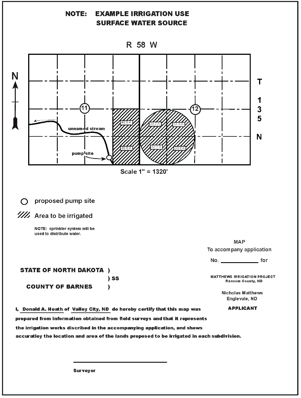
a. The examples shown herein should be used as a guide in preparing the map.
b. The map shall be drawn or generated by computer methods on a 8 1/2” x 11” white 20 bond paper.
HANDWRITTEN INFORMATION WILL NOT BE ACCEPTED.
c. The map must show the following information
£ Section, Township, Range and county designation to satisfactorily locate proposed works.
£ Proposed wells or pump sites within the point(s) of diversion are to be shown by “o” at their proposed
location. (If system is portable, state “portable system” in the lower right hand portion of map.)
£ If use is for irrigation purposes, show proposed wells or pump sites within the point(s) of diversion and
means of conveying water to place of use. Irrigated tracts in each 40 acre subdivision must be indicated
by cross hatching. Include number of acres to be irrigated in each 40 acre subdivision and round o to
the nearest tenth of an acre.
£ If use is for industrial purposes, show proposed wells or pump sites within the point(s) of diversion.
£ If use is for municipal purposes show proposed wells or pump sites within the point(s) of diversion and
the system to convey water to the central storage facility. Map may be drawn in reference to city blocks
but also must show in what legal subdivision works are located. Show section, quarter section or one-
sixteenth section lines as applicable.
£ If application proposes use of a dam and storage reservoir, show the outline of the reservoir with “X”
marked at the point on the reservoir from which the diversion will be made.
£ The watercourse from which water is diverted must be shown and named, and the direction of ow
indicated.
£ A north arrow must be shown.
£ Scale of map must be shown (For example, 1” equals 1000’ is a satisfactory scale for a one square mile
tract of land.)
£ The Department may return the map to the applicant for correction if additional information is needed
to properly evaluate the conditional water permit application.
£ The title in the lower right hand corner of the map must indicate the name of the applicant and post
oce address. (See examples on pages 7, 10, 13, 16, & 19)
£ The Certicate of Surveyor, located in the lower left hand corner of the map, must be signed by a
licensed surveyor and be in the following form:
3
Notication As Required By Statute
Upon receipt of a complete application, completed Notice of Application forms will be forwarded to the applicant along with
a letter of instructions. Applicants are required by law to:
1. Provide notice of the application by certied mail to all record title owners of real estate within a radius of one mile
from the location of the proposed water appropriation site, EXCEPT:
a. If the one-mile radius extends within the geographical boundary of a city, the notice must be given to the
governing body of the city and no further notice need be given to the record title owners of real estate within
the geographical boundary of the city.
b. If the one-mile radius includes land within the geographical boundary of a rural subdivision where the lots
are ten acres or less, the notice must be given to the governing body of the township or other governing
authority for the rural subdivision and no further notice need be given to the record title owners of real estate
within the geographical boundary of the rural subdivision.
c. If the one-mile radius includes a single tract of rural land which is owned by more than ten individuals, the
notice must be given to the governing body of the township or other governing authority for that tract of
land and no further notice need be given to the record title owners of the tract.
NOTE: The record title owners shall be determined by an actual search of the records of the appropriate County
Recorders oce within 15 days of the mailing of the notice to landowners. The record title owners of land under
contract for deed shall be deemed to include both grantor and grantee of a contract for deed.
2. Provide notice of application by certied mail to each person holding a water permit for the appropriation of water
from an appropriation site located within a radius of one mile from the location of the “proposed” appropriation site.
The Department of Water Resources will provide the applicant a list of permit holders who must be notied.
3. Provide notice of application by certied mail to all municipal or public use permit holders within a twelve-mile
radius of the “proposed” water appropriation site. The Department of Water Resources will provide the applicant a list
of all municipal or public use permit holders that must be notied.
4. After sending the completed Notice of Application forms by certied mail, the applicant must return, within sixty
days from the date of the DWR’s notication instructions, by certied mail, the completed adavit of notice and
Postal Service form 3877.
Upon receipt of the completed adavit of notice and Postal Service form 3877, the Department of Water Resources
shall publish notice of the application in the ocial newspaper of the county in which the proposed appropriation
site is located, once a week for two consecutive weeks. The applicant is required to pay the publication fees for the
Notice of Application.
5. The Notice of Application will give essential facts about the application and the date by which written comments
regarding the proposed appropriation must be led with the Department of Water Resources.
a. The Department of Water Resources shall consider all written comments received and shall draft a
recommended decision in writing. The recommended decision is mailed to the applicant and any person who
led written comments (parties of record).
b. Within thirty days of service of the recommended decision, the applicant and any party
c. Of record who would be aggrieved by the decision may le additional written comments with the
Department of Water Resources or request an adjudicative proceeding on the application, or both. A request
for an adjudicative proceeding must be made in writing and must state with particularity how the person
would be aggrieved by the decision and the issues and facts to be presented at the proceeding. If a request
for an adjudicative proceeding is not made, the Department shall consider the additional comments, if
any are submitted, and issue a nal decision. If a request for an adjudicative proceeding is made and the
Department determines an adjudicative proceeding is necessary, the Department shall designate a time and
place for the adjudicative proceeding and serve the notice of adjudicative proceeding upon the applicant and
any person who led written comments.

4
SAMPLE
Name of Applicant
Address City State ZIP Code
Home Telephone Number Work Telephone Number
Cell Phone Number Email Address
2. Source of water supply:
If Surface Water:
If the requested surface water source is a navigable water as determined by the Department of Water Resources,
a Sovereign Land Permit may be required. Contact the Regulatory Division at (701) 328-4956 for more information.
(a) Source Name
(b) If New Impoundment 1/4 Section Township Range
(c) If Existing Impoundment, give name
(d) Existing Impoundment 1/4 Section Township Range
3. Point Of Diversion:
(1) 1/4 Section Township N. Range W. County
(2) 1/4 Section Township N. Range W. County
(3) 1/4 Section Township N. Range W. County
(4) 1/4 Section Township N. Range W. County
4. Amount Of Water Requested:
If the impoundment can store more than 25 acre-feet, a Construction Permit from the Department of Water Resources
may be required. Contact the Regulatory Division at (701) 328-4956 for more information.
(A) Annual Use From Points Listed In Item 3 Above, Rate Of Diversion, And Period Of Use:
Amount (acre-feet) Rate At (gpm) From (month/day) To (month/day)
(b) If impoundment:
Storage Out (acre-feet) Used To Offset Evaporative Losses (acre-feet)
(C) Total annual use requested (sum of annual use from 4a and evaporation from 4b):
Total (acre-feet)
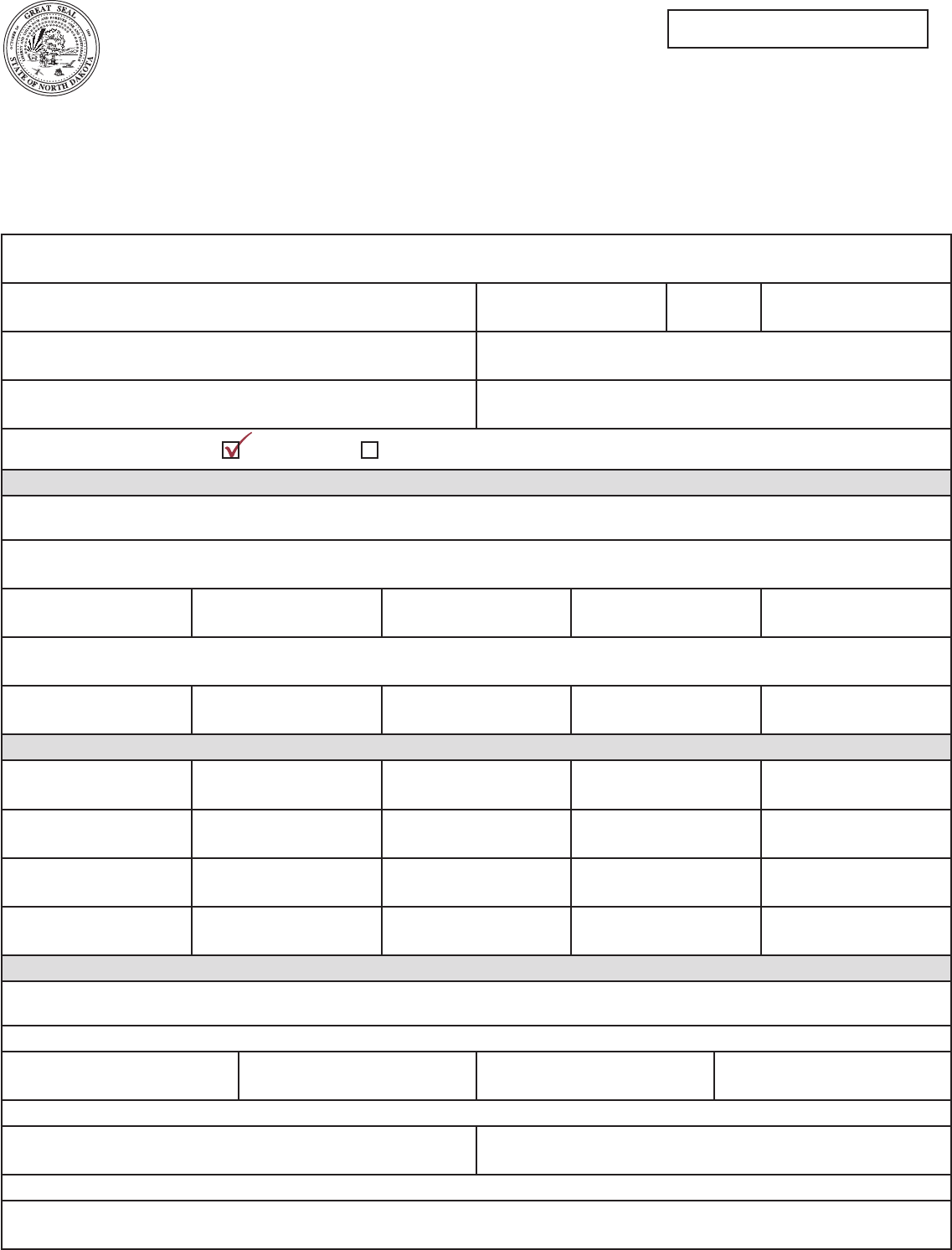
NICHOLAS MATTHEWS
(SURFACE WATER IRRIGATION)
6073 16TH STREET NW ENGLEVALE
701-579-1955
701-425-1997
UNNAMED CREEK
322.5
701-579-1995
DAWATER@NHOW.NET
ND 58028
SE 11 135 58 RANSOM
322.5 1,500 APRIL 1 OCT. 1
Application Number
NOTE: Use one application for each type of source (ground water, surface water). Check all appropriate boxes and ll in each blank line.
If the question is not applicable to your proposed development, enter NA (not applicable). If more space is necessary, attach additional sheets.
(PLEASE DO NOT SUBMIT A COPY OF THIS APPLICATION FORM.)
MAIL THE COMPLETED APPLICATION, ALONG WITH THE REQUIRED MAP AND APPLICATION FEE TO:
ND DEPARTMENT OF WATER RESOURCES ● 1200 MEMORIAL HIGHWAY ● BISMARCK, ND 58504-5262
NORTH DAKOTA DEPARTMENT OF WATER RESOURCES
APPLICATION FOR CONDITIONAL WATER PERMIT
WATER APPROPRIATION
SFN 60157 (2/2023)
Ground Water Surface Water
SAMPLE

5
SAMPLE
SAMPLE
5. Description Of Proposed Benecial Water Uses:
(a) Irrigation (If applicable)
(1) Method of Irrigation:
(2) Project will involve new irrigated land:
(3) Project will involve supplemental water to existing irrigation:
(4) Description of land to be irrigated (show lot numbers where applicable). Requested acres must match what is requested on map:
SEC. TWP. RGE.
NE 1/4 NW 1/4 SW 1/4 SE 1/4 T
O
T
A
L
NE
1/4
NW
1/4
SW
1/4
SE
1/4
NE
1/4
NW
1/4
SW
1/4
SE
1/4
NE
1/4
NW
1/4
SW
1/4
SE
1/4
NE
1/4
NW
1/4
SW
1/4
SE
1/4
TOTAL NUMBER OF ACRES TO BE IRRIGATED:
(b) Non-Irrigation Use (if applicable):
Municipal Recreation
Rural Water Fish and Wildlife
Industrial Other (please specify)
6. Ownership:
(a) Property owner at the point of diversion:
(b) Property owner at the place of use (irrigation use only):
(c) If either (a) or (b) are not the applicant, a landowner or access agreement is required to be submitted with the application.
State law requires that cities and landowners within a one-mile radius of the proposed point of diversion be advised of this application.
A completed “Notice of Application” will be forwarded to you upon receipt of this application.
THE APPLICANT CERTIFIES THAT THE STATEMENTS APPEARING HEREIN
ARE TO THE BEST OF HIS KNOWLEDGE TRUE AND CORRECT:
Signature Print Name Date
Signature Print Name Date
Signature Print Name Date
Signature of the applicant(s) must be exactly as in item 1. If more than one applicant is shown, all must sign.
NICHOLAS MATTHEWS
NICHOLAS MATTHEWS
11
12
135
135
58
58 33.8 33.7 33.7 33.8
40 40 80
135
215
Sprinkler
Yes
Yes
Waterspreading Flood
Drip
No
No
SFN 60157 (2/2023)
Page 2 of 2
Nicholas Matthews 4-18-12
6
SAMPLE
7
SAMPLE
Name of Applicant
Address City State ZIP Code
Home Telephone Number Work Telephone Number
Cell Phone Number Email Address
2. Source of water supply:
If Surface Water:
If the requested surface water source is a navigable water as determined by the Department of Water Resources,
a Sovereign Land Permit may be required. Contact the Regulatory Division at (701) 328-4956 for more information.
(a) Source Name
(b) If New Impoundment 1/4 Section Township Range
(c) If Existing Impoundment, give name
(d) Existing Impoundment 1/4 Section Township Range
3. Point Of Diversion:
(1) 1/4 Section Township N. Range W. County
(2) 1/4 Section Township N. Range W. County
(3) 1/4 Section Township N. Range W. County
(4) 1/4 Section Township N. Range W. County
4. Amount Of Water Requested:
If the impoundment can store more than 25 acre-feet, a Construction Permit from the Department of Water Resources
may be required. Contact the Regulatory Division at (701) 328-4956 for more information.
(A) Annual Use From Points Listed In Item 3 Above, Rate Of Diversion, And Period Of Use:
Amount (acre-feet) Rate At (gpm) From (month/day) To (month/day)
(b) If impoundment:
Storage Out (acre-feet) Used To Offset Evaporative Losses (acre-feet)
(C) Total annual use requested (sum of annual use from 4a and evaporation from 4b):
Total (acre-feet)
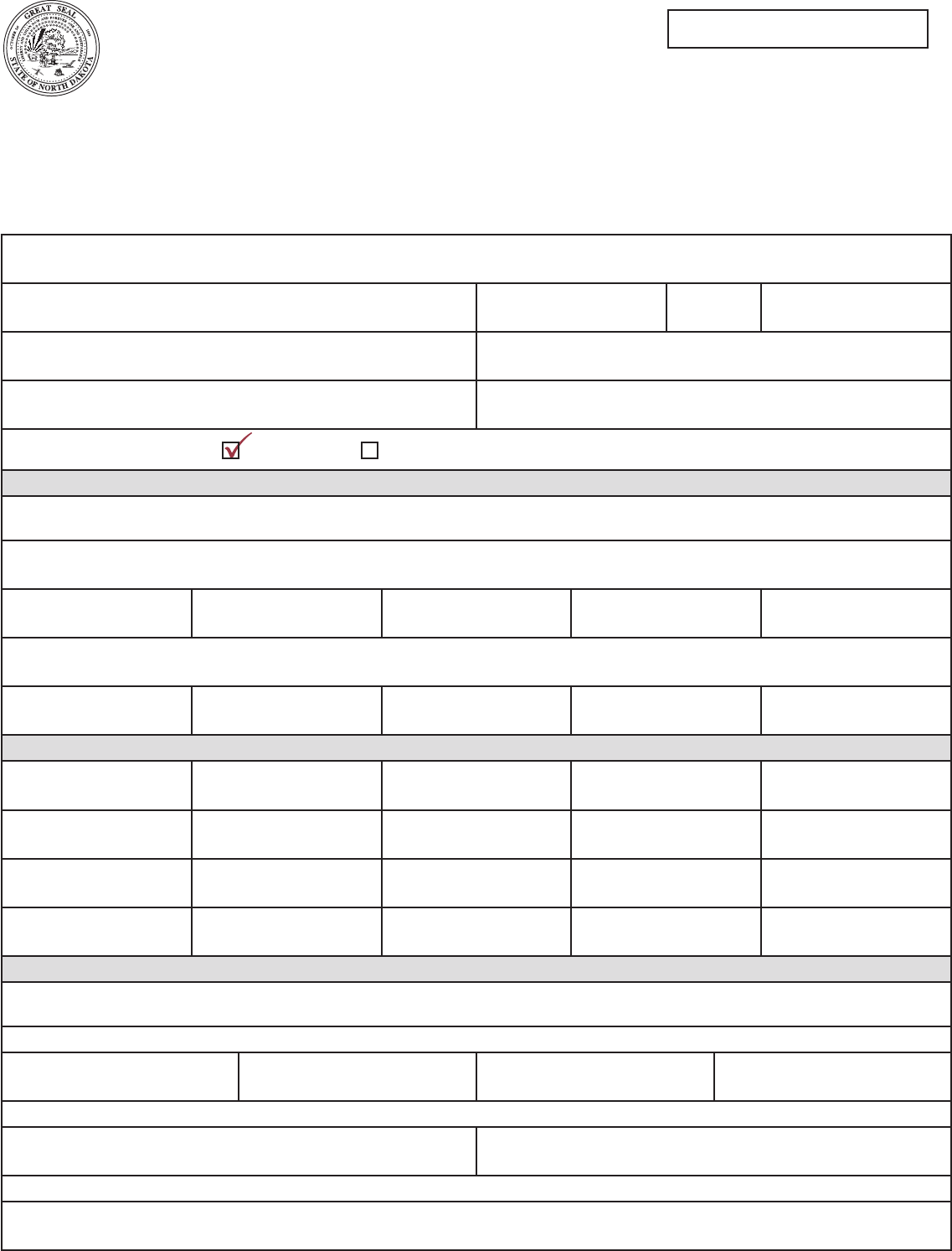
NICHOLAS MATTHEWS
(GROUND WATER IRRIGATION)
6073 16TH STREET NW ENGLEVALE
701-579-1955
701-425-1997
322.5
701-579-1995
DAWATER@NHOW.NET
ND 58028
SE
SW
11
12
135
135
58
58
RANSOM
RANSOM
322.5 1,500 APRIL 1 OCT. 1
Application Number
NOTE: Use one application for each type of source (ground water, surface water). Check all appropriate boxes and ll in each blank line.
If the question is not applicable to your proposed development, enter NA (not applicable). If more space is necessary, attach additional sheets.
(PLEASE DO NOT SUBMIT A COPY OF THIS APPLICATION FORM.)
MAIL THE COMPLETED APPLICATION, ALONG WITH THE REQUIRED MAP AND APPLICATION FEE TO:
ND DEPARTMENT OF WATER RESOURCES ● 1200 MEMORIAL HIGHWAY ● BISMARCK, ND 58504-5262
NORTH DAKOTA DEPARTMENT OF WATER RESOURCES
APPLICATION FOR CONDITIONAL WATER PERMIT
WATER APPROPRIATION
SFN 60157 (2/2023)
Ground Water Surface Water

8
SAMPLE
5. Description Of Proposed Benecial Water Uses:
(a) Irrigation (If applicable)
(1) Method of Irrigation:
(2) Project will involve new irrigated land:
(3) Project will involve supplemental water to existing irrigation:
(4) Description of land to be irrigated (show lot numbers where applicable). Requested acres must match what is requested on map:
SEC. TWP. RGE.
NE 1/4 NW 1/4 SW 1/4 SE 1/4 T
O
T
A
L
NE
1/4
NW
1/4
SW
1/4
SE
1/4
NE
1/4
NW
1/4
SW
1/4
SE
1/4
NE
1/4
NW
1/4
SW
1/4
SE
1/4
NE
1/4
NW
1/4
SW
1/4
SE
1/4
TOTAL NUMBER OF ACRES TO BE IRRIGATED:
(b) Non-Irrigation Use (if applicable):
Municipal Recreation
Rural Water Fish and Wildlife
Industrial Other (please specify)
6. Ownership:
(a) Property owner at the point of diversion:
(b) Property owner at the place of use (irrigation use only):
(c) If either (a) or (b) are not the applicant, a landowner or access agreement is required to be submitted with the application.
State law requires that cities and landowners within a one-mile radius of the proposed point of diversion be advised of this application.
A completed “Notice of Application” will be forwarded to you upon receipt of this application.
THE APPLICANT CERTIFIES THAT THE STATEMENTS APPEARING HEREIN
ARE TO THE BEST OF HIS KNOWLEDGE TRUE AND CORRECT:
Signature Print Name Date
Signature Print Name Date
Signature Print Name Date
Signature of the applicant(s) must be exactly as in item 1. If more than one applicant is shown, all must sign.
NICHOLAS MATTHEWS
NICHOLAS MATTHEWS
11
12
135
135
58
58 33.8 33.7 33.7 33.8
40 40 80
135
215
No
Sprinkler
Yes
Yes
Waterspreading Flood Drip
No
No
SFN 60157 (2/2023)
Page 2 of 2
Nicholas Matthews 4-18-12

9
SAMPLE
10
SAMPLE
Name of Applicant
Address City State ZIP Code
Home Telephone Number Work Telephone Number
Cell Phone Number Email Address
2. Source of water supply:
If Surface Water:
If the requested surface water source is a navigable water as determined by the Department of Water Resources,
a Sovereign Land Permit may be required. Contact the Regulatory Division at (701) 328-4956 for more information.
(a) Source Name
(b) If New Impoundment 1/4 Section Township Range
(c) If Existing Impoundment, give name
(d) Existing Impoundment 1/4 Section Township Range
3. Point Of Diversion:
(1) 1/4 Section Township N. Range W. County
(2) 1/4 Section Township N. Range W. County
(3) 1/4 Section Township N. Range W. County
(4) 1/4 Section Township N. Range W. County
4. Amount Of Water Requested:
If the impoundment can store more than 25 acre-feet, a Construction Permit from the Department of Water Resources
may be required. Contact the Regulatory Division at (701) 328-4956 for more information.
(A) Annual Use From Points Listed In Item 3 Above, Rate Of Diversion, And Period Of Use:
Amount (acre-feet) Rate At (gpm) From (month/day) To (month/day)
(b) If impoundment:
Storage Out (acre-feet) Used To Offset Evaporative Losses (acre-feet)
(C) Total annual use requested (sum of annual use from 4a and evaporation from 4b):
Total (acre-feet)
PRAIRIE WINDS GOLF COURSE
(GOLF COURSE IRRIGATION)
PO BOX 123 HOVEVILLE
47.1
701- 654 -7611
TEEUP@NHOW.NET
ND 58765
SE 11 153 64 RAMSEY
47.1 350 APRIL 1 OCT. 1
Application Number
NOTE: Use one application for each type of source (ground water, surface water). Check all appropriate boxes and ll in each blank line.
If the question is not applicable to your proposed development, enter NA (not applicable). If more space is necessary, attach additional sheets.
(PLEASE DO NOT SUBMIT A COPY OF THIS APPLICATION FORM.)
MAIL THE COMPLETED APPLICATION, ALONG WITH THE REQUIRED MAP AND APPLICATION FEE TO:
ND DEPARTMENT OF WATER RESOURCES ● 1200 MEMORIAL HIGHWAY ● BISMARCK, ND 58504-5262
NORTH DAKOTA DEPARTMENT OF WATER RESOURCES
APPLICATION FOR CONDITIONAL WATER PERMIT
WATER APPROPRIATION
SFN 60157 (2/2023)
Ground Water Surface Water
SAMPLE
11
SAMPLE
SAMPLE
5. Description Of Proposed Benecial Water Uses:
(a) Irrigation (If applicable)
(1) Method of Irrigation:
(2) Project will involve new irrigated land:
(3) Project will involve supplemental water to existing irrigation:
(4) Description of land to be irrigated (show lot numbers where applicable). Requested acres must match what is requested on map:
SEC. TWP. RGE.
NE 1/4 NW 1/4 SW 1/4 SE 1/4 T
O
T
A
L
NE
1/4
NW
1/4
SW
1/4
SE
1/4
NE
1/4
NW
1/4
SW
1/4
SE
1/4
NE
1/4
NW
1/4
SW
1/4
SE
1/4
NE
1/4
NW
1/4
SW
1/4
SE
1/4
TOTAL NUMBER OF ACRES TO BE IRRIGATED:
(b) Non-Irrigation Use (if applicable):
Municipal Recreation
Rural Water Fish and Wildlife
Industrial Other (please specify)
6. Ownership:
(a) Property owner at the point of diversion:
(b) Property owner at the place of use (irrigation use only):
(c) If either (a) or (b) are not the applicant, a landowner or access agreement is required to be submitted with the application.
State law requires that cities and landowners within a one-mile radius of the proposed point of diversion be advised of this application.
A completed “Notice of Application” will be forwarded to you upon receipt of this application.
THE APPLICANT CERTIFIES THAT THE STATEMENTS APPEARING HEREIN
ARE TO THE BEST OF HIS KNOWLEDGE TRUE AND CORRECT:
Signature Print Name Date
Signature Print Name Date
Signature Print Name Date
Signature of the applicant(s) must be exactly as in item 1. If more than one applicant is shown, all must sign.
PRAIRIE WINDS GOLF COURSE
PRAIRIE WINDS GOLF COURSE
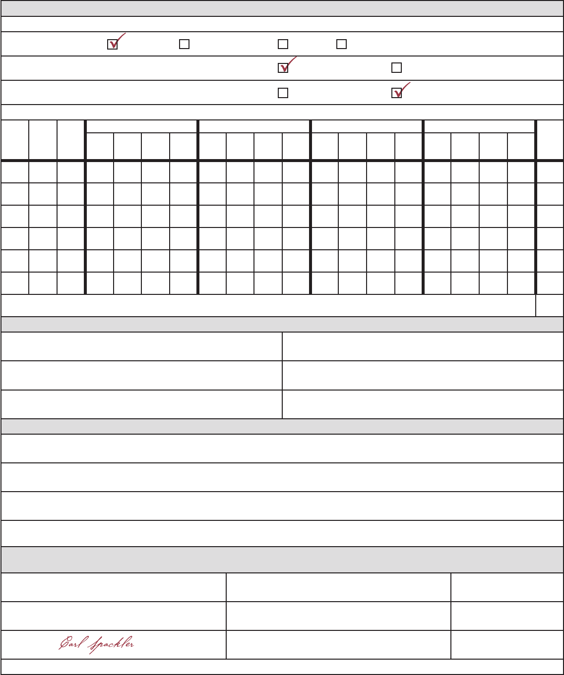
11 153 64 12.3 7. 3 8.1 3.7 31.4
31.4
Sprinkler
Yes
Yes
Waterspreading Flood
Drip
No
No
SFN 60157 (2/2023)
Page 2 of 2
Carl Spackler 4-18-12

12
SAMPLE

13
SAMPLE
Name of Applicant
Address City State ZIP Code
Home Telephone Number Work Telephone Number
Cell Phone Number Email Address
2. Source of water supply:
If Surface Water:
If the requested surface water source is a navigable water as determined by the Department of Water Resources,
a Sovereign Land Permit may be required. Contact the Regulatory Division at (701) 328-4956 for more information.
(a) Source Name
(b) If New Impoundment 1/4 Section Township Range
(c) If Existing Impoundment, give name
(d) Existing Impoundment 1/4 Section Township Range
3. Point Of Diversion:
(1) 1/4 Section Township N. Range W. County
(2) 1/4 Section Township N. Range W. County
(3) 1/4 Section Township N. Range W. County
(4) 1/4 Section Township N. Range W. County
4. Amount Of Water Requested:
If the impoundment can store more than 25 acre-feet, a Construction Permit from the Department of Water Resources
may be required. Contact the Regulatory Division at (701) 328-4956 for more information.
(A) Annual Use From Points Listed In Item 3 Above, Rate Of Diversion, And Period Of Use:
Amount (acre-feet) Rate At (gpm) From (month/day) To (month/day)
(b) If impoundment:
Storage Out (acre-feet) Used To Offset Evaporative Losses (acre-feet)
(C) Total annual use requested (sum of annual use from 4a and evaporation from 4b):
Total (acre-feet)
432-249-0961
RED CROWN OIL COMPANY
(INDUSTRIAL USE)
BOX 1040 MARFA
20
432-249-1030
DODRILLING@TXNET.COM
TX 79843
SE 23 152 102 MCKENZIE
20 13.0 JAN. 1 DEC. 1
Application Number
NOTE: Use one application for each type of source (ground water, surface water). Check all appropriate boxes and ll in each blank line.
If the question is not applicable to your proposed development, enter NA (not applicable). If more space is necessary, attach additional sheets.
(PLEASE DO NOT SUBMIT A COPY OF THIS APPLICATION FORM.)
MAIL THE COMPLETED APPLICATION, ALONG WITH THE REQUIRED MAP AND APPLICATION FEE TO:
ND DEPARTMENT OF WATER RESOURCES ● 1200 MEMORIAL HIGHWAY ● BISMARCK, ND 58504-5262
NORTH DAKOTA DEPARTMENT OF WATER RESOURCES
APPLICATION FOR CONDITIONAL WATER PERMIT
WATER APPROPRIATION
SFN 60157 (2/2023)
Ground Water Surface Water
14
SAMPLE
5. Description Of Proposed Benecial Water Uses:
(a) Irrigation (If applicable)
(1) Method of Irrigation:
(2) Project will involve new irrigated land:
(3) Project will involve supplemental water to existing irrigation:
(4) Description of land to be irrigated (show lot numbers where applicable). Requested acres must match what is requested on map:
SEC. TWP. RGE.
NE 1/4 NW 1/4 SW 1/4 SE 1/4 T
O
T
A
L
NE
1/4
NW
1/4
SW
1/4
SE
1/4
NE
1/4
NW
1/4
SW
1/4
SE
1/4
NE
1/4
NW
1/4
SW
1/4
SE
1/4
NE
1/4
NW
1/4
SW
1/4
SE
1/4
TOTAL NUMBER OF ACRES TO BE IRRIGATED:
(b) Non-Irrigation Use (if applicable):
Municipal Recreation
Rural Water Fish and Wildlife
Industrial Other (please specify)
6. Ownership:
(a) Property owner at the point of diversion:
(b) Property owner at the place of use (irrigation use only):
(c) If either (a) or (b) are not the applicant, a landowner or access agreement is required to be submitted with the application.
State law requires that cities and landowners within a one-mile radius of the proposed point of diversion be advised of this application.
A completed “Notice of Application” will be forwarded to you upon receipt of this application.
THE APPLICANT CERTIFIES THAT THE STATEMENTS APPEARING HEREIN
ARE TO THE BEST OF HIS KNOWLEDGE TRUE AND CORRECT:
Signature Print Name Date
Signature Print Name Date
Signature Print Name Date
Signature of the applicant(s) must be exactly as in item 1. If more than one applicant is shown, all must sign.
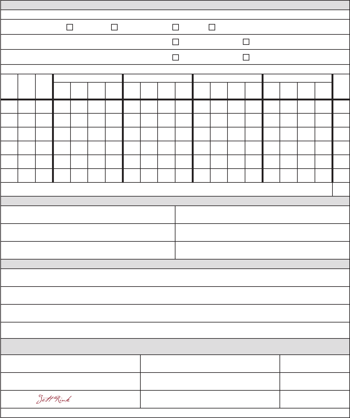
YES
NA
JOHN Q. PUBLIC
JOHN Q. PUBLIC
Sprinkler
Yes
Yes
Waterspreading Flood Drip
No
No
SFN 60157 (2/2023)
Page 2 of 2
Jett Rink 4-18-12

15
SAMPLE
16
SAMPLE
Name of Applicant
Address City State ZIP Code
Home Telephone Number Work Telephone Number
Cell Phone Number Email Address
2. Source of water supply:
If Surface Water:
If the requested surface water source is a navigable water as determined by the Department of Water Resources,
a Sovereign Land Permit may be required. Contact the Regulatory Division at (701) 328-4956 for more information.
(a) Source Name
(b) If New Impoundment 1/4 Section Township Range
(c) If Existing Impoundment, give name
(d) Existing Impoundment 1/4 Section Township Range
3. Point Of Diversion:
(1) 1/4 Section Township N. Range W. County
(2) 1/4 Section Township N. Range W. County
(3) 1/4 Section Township N. Range W. County
(4) 1/4 Section Township N. Range W. County
4. Amount Of Water Requested:
If the impoundment can store more than 25 acre-feet, a Construction Permit from the Department of Water Resources
may be required. Contact the Regulatory Division at (701) 328-4956 for more information.
(A) Annual Use From Points Listed In Item 3 Above, Rate Of Diversion, And Period Of Use:
Amount (acre-feet) Rate At (gpm) From (month/day) To (month/day)
(b) If impoundment:
Storage Out (acre-feet) Used To Offset Evaporative Losses (acre-feet)
(C) Total annual use requested (sum of annual use from 4a and evaporation from 4b):
Total (acre-feet)
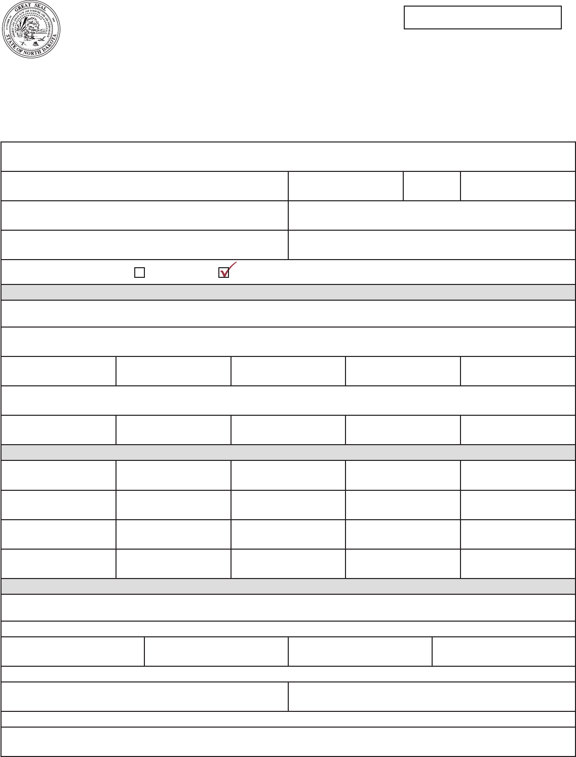
180.0 52.0
ELKHORN RANCH
(SURFACE WATER IMPOUND)
3506 BAD ROUTE ROAD SULLY CREEK
701-783-2478
701-291-0010
UNNAMED CREEK
52.0
ROUNDUP@VIGNET.COM
ND 58001
NW 23 136 102 SLOPE
Application Number
NOTE: Use one application for each type of source (ground water, surface water). Check all appropriate boxes and ll in each blank line.
If the question is not applicable to your proposed development, enter NA (not applicable). If more space is necessary, attach additional sheets.
(PLEASE DO NOT SUBMIT A COPY OF THIS APPLICATION FORM.)
MAIL THE COMPLETED APPLICATION, ALONG WITH THE REQUIRED MAP AND APPLICATION FEE TO:
ND DEPARTMENT OF WATER RESOURCES ● 1200 MEMORIAL HIGHWAY ● BISMARCK, ND 58504-5262
NORTH DAKOTA DEPARTMENT OF WATER RESOURCES
APPLICATION FOR CONDITIONAL WATER PERMIT
WATER APPROPRIATION
SFN 60157 (2/2023)
Ground Water Surface Water
SAMPLE
17
SAMPLE
SAMPLE
5. Description Of Proposed Benecial Water Uses:
(a) Irrigation (If applicable)
(1) Method of Irrigation:
(2) Project will involve new irrigated land:
(3) Project will involve supplemental water to existing irrigation:
(4) Description of land to be irrigated (show lot numbers where applicable). Requested acres must match what is requested on map:
SEC. TWP. RGE.
NE 1/4 NW 1/4 SW 1/4 SE 1/4 T
O
T
A
L
NE
1/4
NW
1/4
SW
1/4
SE
1/4
NE
1/4
NW
1/4
SW
1/4
SE
1/4
NE
1/4
NW
1/4
SW
1/4
SE
1/4
NE
1/4
NW
1/4
SW
1/4
SE
1/4
TOTAL NUMBER OF ACRES TO BE IRRIGATED:
(b) Non-Irrigation Use (if applicable):
Municipal Recreation
Rural Water Fish and Wildlife
Industrial Other (please specify)
6. Ownership:
(a) Property owner at the point of diversion:
(b) Property owner at the place of use (irrigation use only):
(c) If either (a) or (b) are not the applicant, a landowner or access agreement is required to be submitted with the application.
State law requires that cities and landowners within a one-mile radius of the proposed point of diversion be advised of this application.
A completed “Notice of Application” will be forwarded to you upon receipt of this application.
THE APPLICANT CERTIFIES THAT THE STATEMENTS APPEARING HEREIN
ARE TO THE BEST OF HIS KNOWLEDGE TRUE AND CORRECT:
Signature Print Name Date
Signature Print Name Date
Signature Print Name Date
Signature of the applicant(s) must be exactly as in item 1. If more than one applicant is shown, all must sign.
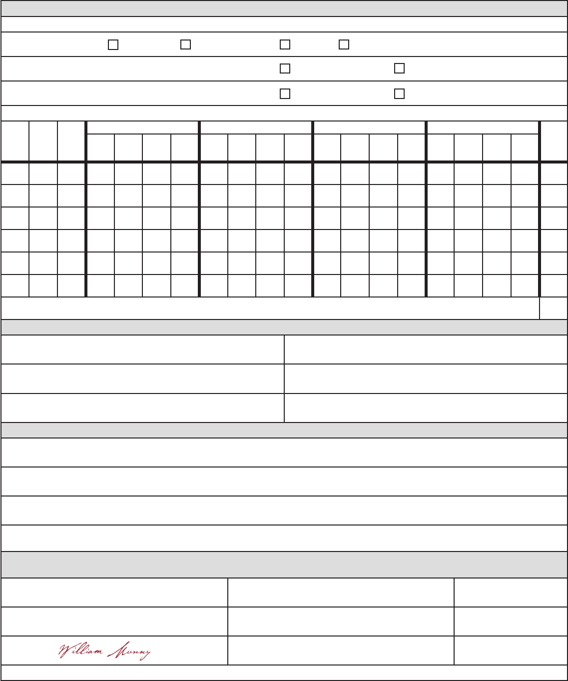
LIVESTOCK
NA
WILLIAM MUNNY
WILLIAM MUNNY
William Munny 4-18-12
Sprinkler
Yes
Yes
Waterspreading Flood
Drip
No
No
SFN 60157 (2/2023)
Page 2 of 2

18

20
1200 Memorial Highway
Bismarck ND 58504-5262
(701) 328.2754
